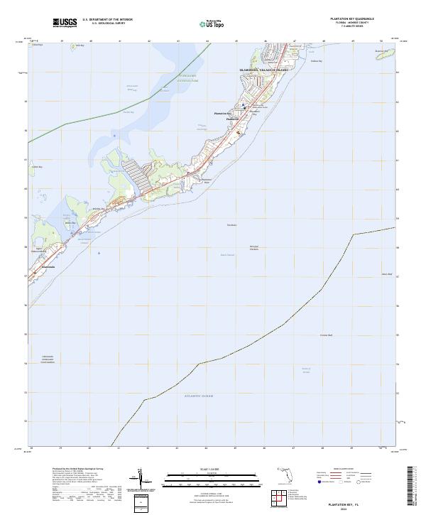
2024 Map of Plantation Key
USGS Topo · Published 2024About this map
Plantation Key and the surrounding archipelagos of the Florida Keys define this maritime landscape, where the terrestrial environment is intricately woven with the surrounding waters of Florida Bay and the Atlantic Ocean. The community of Islamorada, Village of Islands spans several islands, including Windley Key and Upper Matecumbe Key, connected by the corridor of the Florida Keys Overseas Heritage Trail and the Old Overseas Highway. This area represents a modern continuation of the region's transport history, transitioning from the former railway era to a primary focus on tourism and environmental conservation.
Find a feature on this map
55 named features on this map. Tap any name to fly to it.
Don’t see what you’re looking for? This feature index may not catch every label — zoom into the map to look around manually.
Map Details
Editions of this 2024 Plantation Key Map
This is the sole edition of this map. No revisions or reprints were ever made.
Other maps of this area

1947 · Rock Harbor
USGS Topo · 1:24,000

1949 · Rock Harbor
USGS Topo · 1:24,000

1956 · Miami
USGS Topo · 1:250,000

1958 · Miami
USGS Topo · 1:250,000

1971 · Upper Matecumbe Key
USGS Topo · 1:24,000

1971 · Tavernier
USGS Topo · 1:24,000

1971 · Plantation Key
USGS Topo · 1:24,000
1971 · Lower Matecumbe Key
USGS Topo · 1:24,000

1972 · Calusa Keys
USGS Topo · 1:24,000
1982 · Homestead
USGS Topo · 1:100,000
Featured Places
- Islamorada, FL
- Plantation Key, FL
- Plantation, Islamorada
- Plantation Key Colony, Islamorada
- Monroe County, FL