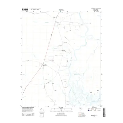
2014 Map of Plantersville
USGS Topo · Published 2014About this map
The Great Pee Dee River and Waccamaw River dominate this Lowcountry landscape, defining the watery boundaries of Sandy Island and the surrounding coastal plains. In this 2014 survey, the community of Plantersville sits at the junction of Plantersville Rd and N Fraser St, serving as a central point for small settlements like Saint Pauls and Gilliard. The map documents a complex network of creeks and branches, including Yauhannah Cr, Cypress Cr, and Chapel Cr, which thread through the low-lying terrain toward the Intracoastal Waterway.
Find a feature on this map
63 named features on this map. Tap any name to fly to it.
Don’t see what you’re looking for? This feature index may not catch every label — zoom into the map to look around manually.
Map Details
Editions of this 2014 Plantersville Map
This is the sole edition of this map. No revisions or reprints were ever made.
Other maps of this area

1942 · Magnolia Beach
USGS Topo · 1:24,000

1942 · Waverly Mills
USGS Topo · 1:24,000

1943 · Yauhannah
USGS Topo · 1:24,000

1943 · Bucksville
USGS Topo · 1:24,000

1943 · Carvers Bay
USGS Topo · 1:24,000

1943 · Brookgreen
USGS Topo · 1:24,000

1943 · Plantersville
USGS Topo · 1:24,000

1943 · Georgetown North
USGS Topo · 1:24,000

1943 · Outland
USGS Topo · 1:24,000

1944 · Outland
USGS Topo · 1:31,680