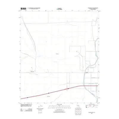
2012 Map of Plaster City
USGS Topo · Published 2012About this map
Plaster City and Dixieland anchor the southern reaches of the Imperial Valley in this 2012 survey, where the arid expanse of the Yuha Desert meets a complex network of agricultural irrigation. The landscape is defined by the sharp transition between the open West Mesa and the engineered waterways essential to local industry and farming. Traces of the region's deeper history are visible in the Old Overland Stage Rte, which cuts across the dry Coyote Wash. The eastern portion of the map reveals a dense infrastructure of named agricultural channels, including the Westside Main Canal and the Foxglove Canal, alongside uniquely named drainage systems such as the Forget-Me-Not Drain. These features reflect the 20th-century transformation of the desert through controlled water management, connecting small industrial hubs like Plaster City to the wider valley economy via the Evan Hewes Hwy.
Find a feature on this map
28 named features on this map. Tap any name to fly to it.
Don’t see what you’re looking for? This feature index may not catch every label — zoom into the map to look around manually.
Map Details
Editions of this 2012 Plaster City Map
This is the sole edition of this map. No revisions or reprints were ever made.
Other maps of this area

1915 · El Centro
USGS Topo · 1:125,000

1940 · Brawley
USGS Topo · 1:62,500

1940 · Heber
USGS Topo · 1:62,500

1940 · Plaster City
USGS Topo · 1:62,500

1940 · Coyote Wells
USGS Topo · 1:62,500

1942 · El Centro
USGS Topo · 1:250,000

1943 · Coyote Wells
USGS Topo · 1:62,500

1943 · Heber
USGS Topo · 1:62,500

1943 · Brawley
USGS Topo · 1:62,500

1944 · Plaster City
USGS Topo · 1:62,500