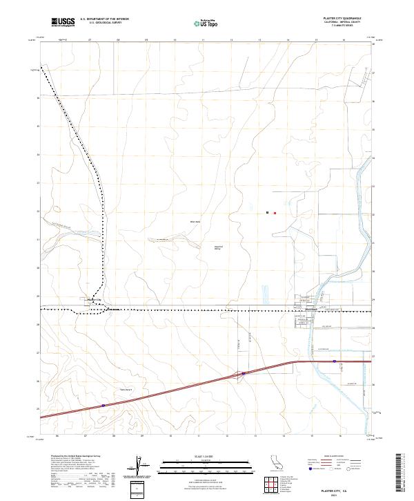
2021 Map of Plaster City
USGS Topo · Published 2021About this map
Plaster City and Dixieland stand as the primary human outposts in this arid landscape where the eastern Yuha Desert meets the Imperial Valley. The environment is defined by an intricate water management system designed to reclaim the desert for agricultural use, evidenced by the extensive network of the Westside Main Canal, Foxglove Canal, and uniquely named features like the Forget-Me-Not Canal and Forget-Me-Not Drain. These artificial waterways contrast sharply with the natural, ephemeral flows of Coyote Wash and Yuha Wash. Historically significant transport lines are visible, notably the path of the Old Overland Stage Rte crossing the West Mesa in the northwest. In the southeast, a structured residential grid appears at Dixieland with named corridors such as Even Hewes Hwy and Magnolia Ave, providing a clear record of local infrastructure and land division in this corner of Imperial County.
Find a feature on this map
39 named features on this map. Tap any name to fly to it.
Don’t see what you’re looking for? This feature index may not catch every label — zoom into the map to look around manually.
Map Details
Editions of this 2021 Plaster City Map
This is the sole edition of this map. No revisions or reprints were ever made.
Other maps of this area

1915 · El Centro
USGS Topo · 1:125,000

1940 · Brawley
USGS Topo · 1:62,500

1940 · Heber
USGS Topo · 1:62,500

1940 · Plaster City
USGS Topo · 1:62,500

1940 · Coyote Wells
USGS Topo · 1:62,500

1942 · El Centro
USGS Topo · 1:250,000

1943 · Coyote Wells
USGS Topo · 1:62,500

1943 · Heber
USGS Topo · 1:62,500

1943 · Brawley
USGS Topo · 1:62,500

1944 · Plaster City
USGS Topo · 1:62,500