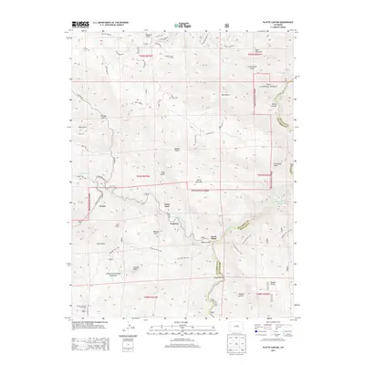
2013 Map of Platte Canyon
USGS Topo · Published 2013About this map
South Platte and the mountain settlement of Foxton stand at the heart of this mountain landscape where the North Fork South Platte River joins the main branch of the South Platte River. The terrain is defined by massive granite formations and high peaks, including the prominent Dome Rock and the towering Raleigh Peak. Much of the area is protected within the Pike National Forest, where the famous Colorado Trail 1776 winds through the hills. To the northeast, the Strontia Springs Reservoir sits near the border of Jefferson and Douglas counties. This 2013 survey illustrates the complex intersection of wild lands and small communities like Longview and Critchell, connected by winding routes such as S Foxton Rd and N Platte River Rd. The map also captures local landmarks like the Top of the World Picnic Area and numerous named gulches that feed the river system.
Find a feature on this map
67 named features on this map. Tap any name to fly to it.
Don’t see what you’re looking for? This feature index may not catch every label — zoom into the map to look around manually.
Map Details
Editions of this 2013 Platte Canyon Map
This is the sole edition of this map. No revisions or reprints were ever made.
Other maps of this area

1893 · Platte Canyon
USGS Topo · 1:125,000

1899 · West Denver
USGS Topo · 1:125,000

1942 · Littleton
USGS Topo · 1:31,680

1945 · Indian Hills
USGS Topo · 1:31,680

1945 · Platte Canyon
USGS Topo · 1:24,000

1945 · Pine
USGS Topo · 1:24,000

1945 · Kassler
USGS Topo · 1:24,000

1948 · Kassler
USGS Topo · 1:24,000

1948 · Pine
USGS Topo · 1:24,000

1948 · Platte Canyon
USGS Topo · 1:24,000