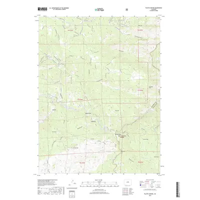
2019 Map of Platte Canyon
USGS Topo · Published 2019About this map
Longview and Foxton serve as primary points of interest along the drainage of the North Fork South Platte River in this part of the Front Range. The landscape is defined by its dramatic geological formations, with distinctive landmarks such as Dome Rock, Chair Rocks, and Raleigh Peak rising above the river valley. Much of the southern and eastern territory is protected within the Pike National Forest, where the topography descends sharply into the Platte Canyon. The confluence at South Platte and the nearby Strontia Spring highlight the critical water systems of the region. A network of specialized trails, including the Elkhorn Trail, Songbird Trail, and Oxen Draw Trail, illustrates the modern recreational character of the land, weaving through gulches named for local wildlife and the pioneering samplers of the terrain like the Raymers and Kennedy families.
Find a feature on this map
75 named features on this map. Tap any name to fly to it.
Don’t see what you’re looking for? This feature index may not catch every label — zoom into the map to look around manually.
Map Details
Editions of this 2019 Platte Canyon Map
This is the sole edition of this map. No revisions or reprints were ever made.
Other maps of this area

1893 · Platte Canyon
USGS Topo · 1:125,000

1899 · West Denver
USGS Topo · 1:125,000

1942 · Littleton
USGS Topo · 1:31,680

1945 · Indian Hills
USGS Topo · 1:31,680

1945 · Platte Canyon
USGS Topo · 1:24,000

1945 · Pine
USGS Topo · 1:24,000

1945 · Kassler
USGS Topo · 1:24,000

1948 · Kassler
USGS Topo · 1:24,000

1948 · Pine
USGS Topo · 1:24,000

1948 · Platte Canyon
USGS Topo · 1:24,000