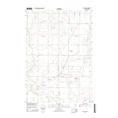
2014 Map of Platte River
USGS Topo · Published 2014About this map
Platte River winds through this section of Benzie County, anchoring a landscape defined by glacial lakes and a complex network of rural roads. The topography is marked by significant water bodies including Pigeon Lake in the northwest and the twin basins of Upper Woodcock Lake and Lower Woodcock Lake to the east. The human footprint is visible in the distribution of local landmarks such as Almira Cem and Brundage Cem, while transportation history is preserved through named crossings like Haze Bridge and Case Bridge. The presence of the Lake Ann Airway Estates Airport suggests a specialized pattern of modern residential development centered on aviation. This 2014 survey documents a transition between preserved natural spaces like Memorial Park and the established rural homesteads along Maple City Hwy and Steam Hauler Rd, reflecting the enduring character of northern Michigan's inland township geography.
Find a feature on this map
84 named features on this map. Tap any name to fly to it.
Don’t see what you’re looking for? This feature index may not catch every label — zoom into the map to look around manually.
Map Details
Editions of this 2014 Platte River Map
This is the sole edition of this map. No revisions or reprints were ever made.
Other maps of this area

1954 · Traverse City
USGS Topo · 1:250,000

1954 · Manitowoc
USGS Topo · 1:250,000

1956 · Thompsonville
USGS Topo · 1:62,500

1956 · Frankfort
USGS Topo · 1:62,500

1957 · Empire
USGS Topo · 1:62,500

1957 · Maple City
USGS Topo · 1:62,500

1958 · Traverse City
USGS Topo · 1:250,000

1958 · Manitowoc
USGS Topo · 1:250,000

1976 · Thompsonville NE
USGS Topo · 1:24,000

1976 · Frankfort SE
USGS Topo · 1:24,000