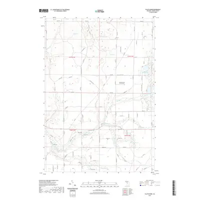
2019 Map of Platte River
USGS Topo · Published 2019About this map
The Platte River meanders through the heart of Benzie County, anchoring a landscape defined by glacial lakes and established timberlands. This modern survey reflects the rural character of Inland Township, where the Shore to Shore Trail provides a continuous thread for hikers and riders across the region. Notable local landmarks include the Lake Ann Airway Estates Airport and several community burial grounds such as Almira Cem and Brundage Cem, which serve as vital touchpoints for genealogists. The map details a high concentration of water bodies, from the secluded Pigeon Lake in the northwest to Lake Louise and the interconnected drainage of Brundage Cr further south. These waterways and the nearby Platte Springs highlight the hydrology that has shaped local settlement and recreation for generations.
Find a feature on this map
89 named features on this map. Tap any name to fly to it.
Don’t see what you’re looking for? This feature index may not catch every label — zoom into the map to look around manually.
Map Details
Editions of this 2019 Platte River Map
This is the sole edition of this map. No revisions or reprints were ever made.
Other maps of this area

1954 · Traverse City
USGS Topo · 1:250,000

1954 · Manitowoc
USGS Topo · 1:250,000

1956 · Thompsonville
USGS Topo · 1:62,500

1956 · Frankfort
USGS Topo · 1:62,500

1957 · Empire
USGS Topo · 1:62,500

1957 · Maple City
USGS Topo · 1:62,500

1958 · Traverse City
USGS Topo · 1:250,000

1958 · Manitowoc
USGS Topo · 1:250,000

1976 · Thompsonville NE
USGS Topo · 1:24,000

1976 · Frankfort SE
USGS Topo · 1:24,000