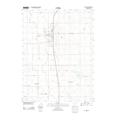
2013 Map of Platteville
USGS Topo · Published 2013About this map
Platteville serves as the central hub of this Weld County landscape, where the town grid is defined by streets like N Main St and Grand Ave adjacent to the Us-85 corridor. The surrounding terrain is heavily modified for agriculture, characterized by an intricate network of irrigation features including the Platte Valley Ditch, Farmers Independent Ditch, and the Spear Canal. These waterways divert from the S Platte River, which meanders through the western portion of the quadrangle.
Find a feature on this map
66 named features on this map. Tap any name to fly to it.
Don’t see what you’re looking for? This feature index may not catch every label — zoom into the map to look around manually.
Map Details
Editions of this 2013 Platteville Map
This is the sole edition of this map. No revisions or reprints were ever made.
Other maps of this area

1902 · Greeley
USGS Topo · 1:125,000

1949 · Gowanda
USGS Topo · 1:24,000

1949 · Fort Lupton
USGS Topo · 1:24,000

1949 · Platteville
USGS Topo · 1:24,000

1949 · Hudson
USGS Topo · 1:24,000

1950 · Frederick
USGS Topo · 1:24,000

1950 · Gowanda
USGS Topo · 1:24,000

1950 · Platteville
USGS Topo · 1:24,000
1950 · Fort Lupton
USGS Topo · 1:24,000

1950 · Johnstown
USGS Topo · 1:24,000