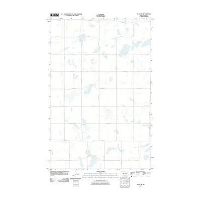
2011 Map of Plaza SE
USGS Topo · Published 2011About this map
Glacial prairie potholes and intermittent wetlands dominate this section of Ward County, where the landscape is meticulously organized by the Public Land Survey System. The area is defined by a rigid grid of gravel and section-line roads, such as 107th Ave Sw and 380th St Sw, which facilitate the region's agricultural transport. Unlike more densely populated regions, this quadrangle highlights the intersection of natural topography and human geometry, as roads like 163rd Ave Sw navigate around numerous unnamed sloughs and basins typical of the North Dakota prairie. This 2011 survey, published by the U.S. Geological Survey, provides a clear view of rural land management and the persistence of the traditional township-and-range road network in the 21st century.
Find a feature on this map
16 named features on this map. Tap any name to fly to it.
Don’t see what you’re looking for? This feature index may not catch every label — zoom into the map to look around manually.
Map Details
Editions of this 2011 Plaza SE Map
This is the sole edition of this map. No revisions or reprints were ever made.
Other maps of this area

1954 · Minot
USGS Topo · 1:250,000

1954 · McClusky
USGS Topo · 1:250,000

1958 · McClusky
USGS Topo · 1:250,000

1958 · Minot
USGS Topo · 1:250,000

1980 · Minot
USGS Topo · 1:100,000

1980 · Plaza SE
USGS Topo · 1:24,000

1980 · Makoti
USGS Topo · 1:24,000

1980 · Rice Lake NW
USGS Topo · 1:24,000
1980 · Plaza
USGS Topo · 1:24,000
1980 · Underdahl Lake
USGS Topo · 1:24,000