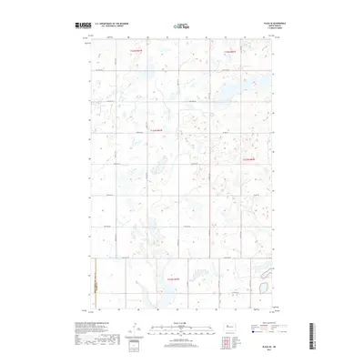
2017 Map of Plaza SE
USGS Topo · Published 2017About this map
Glacial potholes and small wetlands dominate the landscape across the boundary of Mountrail Co Ward Co in this 2017 study. The terrain is defined by a rigorous section-line road grid, including 380th St SW and 366th St SW, which carve through the prairie to support isolated agricultural operations. This area of North Dakota exhibits a highly organized land-use pattern where transportation routes like Co Hwy 16 and Co Hwy 20 connect the vast townships of t153n r87w and t154n r86w. The density of water bodies throughout these townships suggests a landscape shaped by significant post-glacial drainage patterns, influencing the placement of local thoroughfares such as 121st Ave SW and 219th Ave SW.
Find a feature on this map
22 named features on this map. Tap any name to fly to it.
Don’t see what you’re looking for? This feature index may not catch every label — zoom into the map to look around manually.
Map Details
Editions of this 2017 Plaza SE Map
This is the sole edition of this map. No revisions or reprints were ever made.
Other maps of this area

1954 · Minot
USGS Topo · 1:250,000

1954 · McClusky
USGS Topo · 1:250,000

1958 · McClusky
USGS Topo · 1:250,000

1958 · Minot
USGS Topo · 1:250,000

1980 · Minot
USGS Topo · 1:100,000

1980 · Plaza SE
USGS Topo · 1:24,000

1980 · Makoti
USGS Topo · 1:24,000

1980 · Rice Lake NW
USGS Topo · 1:24,000
1980 · Plaza
USGS Topo · 1:24,000
1980 · Underdahl Lake
USGS Topo · 1:24,000