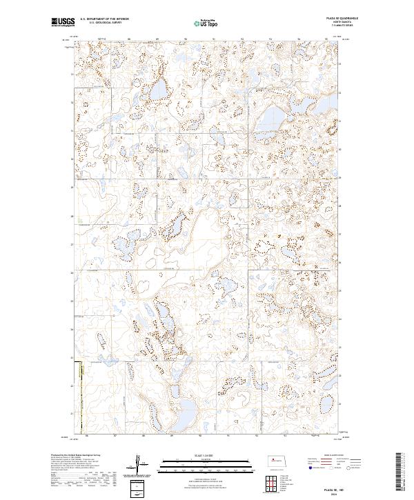
2024 Map of Plaza SE
USGS Topo · Published 2024About this map
The Ward County Waterfowl Production Area dominates this section of the prairie, where numerous wetlands and small water bodies characterize the landscape across the Ward County and Mountrail County line. This 2024 map documents a largely rural and agricultural region defined by a precise section-line road network, including Co Hwy 16, Co Hwy 20, and Co Hwy 9. The terrain is marked by the irregular contours of the prairie pothole region, where glacial depressions have created a dense concentration of small basins and marshes essential for migratory birds. The infrastructure remains strictly aligned with the Public Land Survey System, as seen in the grid formed by 107th Ave SW, 135th Ave SW, and 205th Ave SW, reflecting the persistent spatial organization of the North Dakota plains.
Find a feature on this map
19 named features on this map. Tap any name to fly to it.
Don’t see what you’re looking for? This feature index may not catch every label — zoom into the map to look around manually.
Map Details
Editions of this 2024 Plaza SE Map
This is the sole edition of this map. No revisions or reprints were ever made.
Other maps of this area

1954 · Minot
USGS Topo · 1:250,000

1954 · McClusky
USGS Topo · 1:250,000

1958 · McClusky
USGS Topo · 1:250,000

1958 · Minot
USGS Topo · 1:250,000

1980 · Minot
USGS Topo · 1:100,000

1980 · Plaza SE
USGS Topo · 1:24,000

1980 · Makoti
USGS Topo · 1:24,000

1980 · Rice Lake NW
USGS Topo · 1:24,000
1980 · Plaza
USGS Topo · 1:24,000
1980 · Underdahl Lake
USGS Topo · 1:24,000