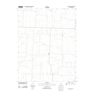
2011 Map of Pleasant Gap
USGS Topo · Published 2011About this map
Pleasant Gap is the central point of this agricultural landscape in Bates County, Missouri. The settlement is surrounded by a network of drainage systems feeding into larger waterways, including South Deepwater Creek and Double Branch. The region's history is anchored by family and community burial grounds such as Smith Cemetery, Myers Cemetery, and Rogers Cemetery, which provide valuable location data for genealogists and local historians. This 2011 survey also highlights the local aviation infrastructure at Bauer PGI Airport, located south of the main village. Numerous tributaries, including Mission Branch, Sycamore Branch, and Willow Branch, crisscross the terrain, reflecting the area's natural drainage patterns and traditional land use. The layout of roads and property lines follows a distinct grid, typical of the Midwestern prairie, punctuated by these meandering natural watercourses.
Find a feature on this map
15 named features on this map. Tap any name to fly to it.
Don’t see what you’re looking for? This feature index may not catch every label — zoom into the map to look around manually.
Map Details
Editions of this 2011 Pleasant Gap Map
This is the sole edition of this map. No revisions or reprints were ever made.
Other maps of this area

1887 · Butler
USGS Topo · 1:125,000

1894 · Butler
USGS Topo · 1:125,000

1934 · Papinsville
USGS Topo · 1:24,000

1934 · Rockville
USGS Topo · 1:24,000

1936 · Rich Hill
USGS Topo · 1:24,000

1947 · Lawrence
USGS Topo · 1:250,000

1950 · Lawrence
USGS Topo · 1:250,000

1953 · Johnstown
USGS Topo · 1:24,000
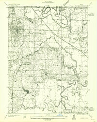
1955 · Rich Hill
USGS Topo · 1:24,000

1956 · Lawrence
USGS Topo · 1:250,000