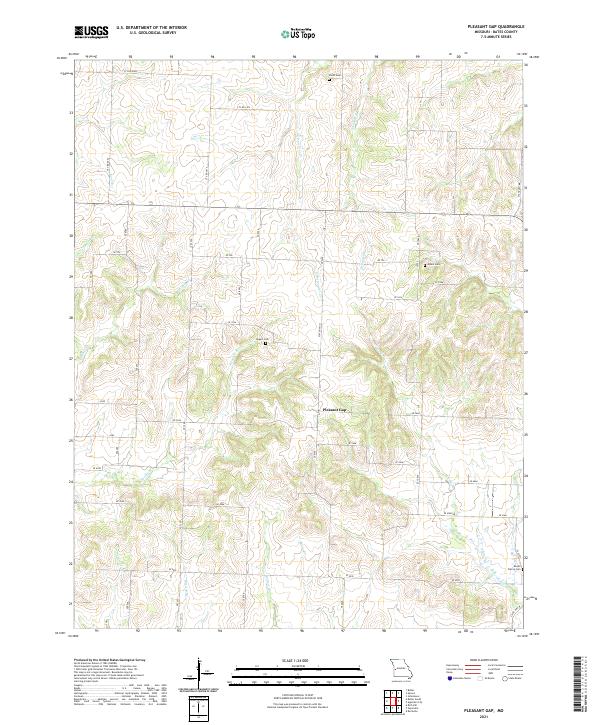
2021 Map of Pleasant Gap
USGS Topo · Published 2021About this map
Pleasant Gap serves as the central point of interest in this portion of Bates County, where a rural network of county roads like CTY RD 2004 and CTY RD 1474 intersects with State HWY O. The landscape is defined by the branching drainage of S Deepwater Cr and several smaller tributaries such as Double Br and Straight Br. These waterways create a undulating terrain of ridges and valleys that have historically dictated the placement of farms and small family burial grounds.
Find a feature on this map
51 named features on this map. Tap any name to fly to it.
Don’t see what you’re looking for? This feature index may not catch every label — zoom into the map to look around manually.
Map Details
Editions of this 2021 Pleasant Gap Map
This is the sole edition of this map. No revisions or reprints were ever made.
Other maps of this area

1887 · Butler
USGS Topo · 1:125,000

1894 · Butler
USGS Topo · 1:125,000

1934 · Papinsville
USGS Topo · 1:24,000

1934 · Rockville
USGS Topo · 1:24,000

1936 · Rich Hill
USGS Topo · 1:24,000

1947 · Lawrence
USGS Topo · 1:250,000

1950 · Lawrence
USGS Topo · 1:250,000

1953 · Johnstown
USGS Topo · 1:24,000
1955 · Rich Hill
USGS Topo · 1:24,000

1956 · Lawrence
USGS Topo · 1:250,000