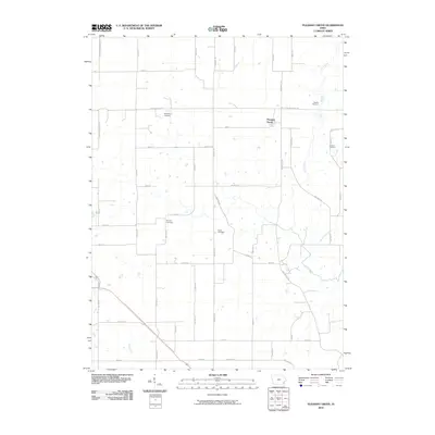
2010 Map of Pleasant Grove
USGS Topo · Published 2010About this map
Pleasant Grove serves as the central hub of this Des Moines County landscape, where the rural road network follows a rigid grid intersected by the meandering paths of Flint Creek and Big Hollow Creek. The geography is defined by its agricultural character and deep-rooted local history, evidenced by a high density of small family or community burial grounds. Genealogists and historians can trace lineage across the township through the Millerburg Cemetery, Galliher Cemetery, Butcher Cemetery, Ramsey Cemetery, and Carter Cemetery. The southwestern corner is further defined by the drainage of Cedar Creek, while a primary corridor is formed by Danville Rd, connecting the scattered farmsteads and residential clusters that characterize this part of southeastern Iowa.
Find a feature on this map
49 named features on this map. Tap any name to fly to it.
Don’t see what you’re looking for? This feature index may not catch every label — zoom into the map to look around manually.
Map Details
Editions of this 2010 Pleasant Grove Map
This is the sole edition of this map. No revisions or reprints were ever made.
Other maps of this area

1934 · Burlington
USGS Topo · 1:48,000

1940 · Burlington
USGS Topo · 1:62,500

1946 · Wapello
USGS Topo · 1:62,500

1949 · Wapello
USGS Topo · 1:62,500

1958 · Burlington
USGS Topo · 1:250,000

1958 · Davenport
USGS Topo · 1:250,000

1961 · Burlington
USGS Topo · 1:250,000

1961 · Davenport
USGS Topo · 1:250,000

1962 · Davenport
USGS Topo · 1:250,000

1963 · Burlington
USGS Topo · 1:250,000