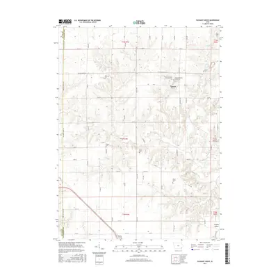
2015 Map of Pleasant Grove
USGS Topo · Published 2015About this map
Pleasant Grove serves as the focal point of this agricultural landscape in Des Moines County, where a network of section roads like Pleasant Grove Rd and Beaverdale Rd crisscross the terrain. The map is particularly valuable for genealogical research, documenting several denominational and family burial sites including the Shinar Cumberland Presbyterian Church Cem and the Siefken Family Plot. The drainage of Flint Creek and its tributary Big Hollow shape the eastern topography, while the Henry Co Des Moines Co boundary defines the western edge. Further south, the small settlement of Prairie Grove sits near the headwaters of Cedar Cr. The distribution of sites like the Welsh Chapel Cem and Millerburg Cem provides evidence of the early settler communities that established themselves along these ridges and creek valleys.
Find a feature on this map
50 named features on this map. Tap any name to fly to it.
Don’t see what you’re looking for? This feature index may not catch every label — zoom into the map to look around manually.
Map Details
Editions of this 2015 Pleasant Grove Map
This is the sole edition of this map. No revisions or reprints were ever made.
Other maps of this area

1934 · Burlington
USGS Topo · 1:48,000

1940 · Burlington
USGS Topo · 1:62,500

1946 · Wapello
USGS Topo · 1:62,500

1949 · Wapello
USGS Topo · 1:62,500

1958 · Burlington
USGS Topo · 1:250,000

1958 · Davenport
USGS Topo · 1:250,000

1961 · Burlington
USGS Topo · 1:250,000

1961 · Davenport
USGS Topo · 1:250,000

1962 · Davenport
USGS Topo · 1:250,000

1963 · Burlington
USGS Topo · 1:250,000