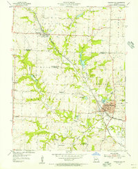
1954 Map of Pleasant Hill
USGS Topo · Published 1955About this map
The railroad junction at Pleasant Hill serves as the focal point of this mid-century survey of the Jackson County and Cass County border. The crossing of the Missouri Pacific and the Chicago Rock Island and Pacific railroads anchors the town's geography, situated near industrial landmarks like the local Power Plant and City Hall. This period depicts a landscape transitioning through educational consolidation, marked by several decommissioned rural schoolhouses including Brush College No 2 Sch and Crossroads Sch.
Find a feature on this map
39 named features on this map. Tap any name to fly to it.
Don’t see what you’re looking for? This feature index may not catch every label — zoom into the map to look around manually.
Map Details
Editions of this 1954 Pleasant Hill Map
2 editions found
Other maps of this area

1887 · Harrisonville
USGS Topo · 1:125,000

1892 · Harrisonville
USGS Topo · 1:125,000

1894 · Harrisonville
USGS Topo · 1:125,000

1934 · Lees Summit
USGS Topo · 1:24,000

1934 · Woods Chapel
USGS Topo · 1:24,000

1935 · Tarsney
USGS Topo · 1:24,000

1939 · Lees Summit
USGS Topo · 1:31,680

1947 · Lawrence
USGS Topo · 1:250,000
1949 · Lees Summit
USGS Topo · 1:24,000

1950 · Lawrence
USGS Topo · 1:250,000