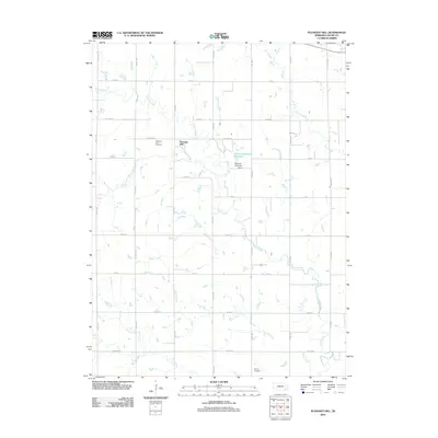
2011 Map of Pleasant Hill
USGS Topo · Published 2011About this map
Pleasant Hill anchors this agricultural landscape in Saline County, where the regular section grid of the Nebraska prairie is broken by an intricate drainage system. The settlement is flanked by the Pleasant Hill Cemetery, while further south, the Summit Cemetery sits near the headwaters of Brush Creek. This 2011 survey reveals how water management has shaped the local topography, most notably at the Mahloch-Kastanek Reservoir and its associated Mahloch-Kastanek Dam along a tributary of Turkey Creek. The map documents a network of named waterways including Coon Creek, Otoe Creek, Spring Creek, and Dry Creek, which dictate the placement of county roads and farmsteads. The transition from the high ground of the cemeteries to the low-lying creek beds illustrates the subtle yet vital relief that defines Nebraska's farming heartland.
Find a feature on this map
30 named features on this map. Tap any name to fly to it.
Don’t see what you’re looking for? This feature index may not catch every label — zoom into the map to look around manually.
Map Details
Editions of this 2011 Pleasant Hill Map
This is the sole edition of this map. No revisions or reprints were ever made.
Other maps of this area

1897 · Lincoln
USGS Topo · 1:125,000

1935 · Dorchester
USGS Topo · 1:48,000

1940 · Dorchester
USGS Topo · 1:62,500

1955 · Lincoln
USGS Topo · 1:250,000

1957 · Lincoln
USGS Topo · 1:250,000

1957 · Wilber
USGS Topo · 1:24,000

1958 · Lincoln
USGS Topo · 1:250,000

1961 · Western
USGS Topo · 1:24,000
1961 · Swanton
USGS Topo · 1:24,000
1964 · Pleasant Hill
USGS Topo · 1:24,000