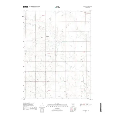
2017 Map of Pleasant Hill
USGS Topo · Published 2017About this map
Pleasant Hill serves as the quiet center of this Saline County landscape, where the prairie is carved by a dense network of watercourses. The drainage of Turkey Creek and its many tributaries, including Coon Creek and Brush Creek, defines the local topography. This area is organized by a precise grid of county roads, such as Co RD 1700 and Co RD HH, which provide access to family farms and several significant community landmarks.
Find a feature on this map
35 named features on this map. Tap any name to fly to it.
Don’t see what you’re looking for? This feature index may not catch every label — zoom into the map to look around manually.
Map Details
Editions of this 2017 Pleasant Hill Map
This is the sole edition of this map. No revisions or reprints were ever made.
Other maps of this area

1897 · Lincoln
USGS Topo · 1:125,000

1935 · Dorchester
USGS Topo · 1:48,000

1940 · Dorchester
USGS Topo · 1:62,500

1955 · Lincoln
USGS Topo · 1:250,000

1957 · Lincoln
USGS Topo · 1:250,000

1957 · Wilber
USGS Topo · 1:24,000

1958 · Lincoln
USGS Topo · 1:250,000

1961 · Western
USGS Topo · 1:24,000
1961 · Swanton
USGS Topo · 1:24,000
1964 · Pleasant Hill
USGS Topo · 1:24,000