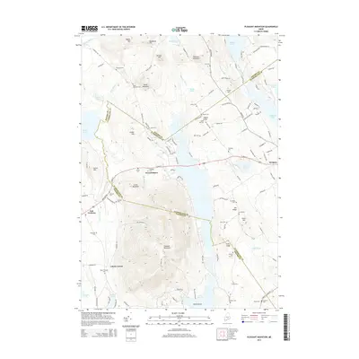
2014 Map of Pleasant Mountain
USGS Topo · Published 2014About this map
Pleasant Mountain anchors this landscape at the intersection of Cumberland and Oxford counties, a region defined by its high ridges and numerous glacial ponds. The settlement of West Bridgton serves as a central point for a network of country roads, including N High St and S Bay Rd, which navigate the elevation changes between Highland Lake and the peak. The sheer density of family-named burial grounds, such as McLucas Cem, Sanborn Cem, and Libby Cem, reveals a deeply rooted rural community structure. To the west, the village of East Fryeburg marks the transition toward the lowlands of Kezar Pond. This modern survey details the contemporary layout of lakeside residences and fire roads, like Fire Tower Rd, while preserving the locations of early landmarks like the Mount Pleasant Cem near Liberty Corner.
Find a feature on this map
132 named features on this map. Tap any name to fly to it.
Don’t see what you’re looking for? This feature index may not catch every label — zoom into the map to look around manually.
Map Details
Editions of this 2014 Pleasant Mountain Map
This is the sole edition of this map. No revisions or reprints were ever made.
Other maps of this area

1896 · Norway
USGS Topo · 1:62,500

1896 · Sebago
USGS Topo · 1:62,500

1909 · Fryeburg
USGS Topo · 1:62,500

1910 · Kezar Falls
USGS Topo · 1:48,000

1911 · Fryeburg
USGS Topo · 1:62,500

1911 · Kezar Falls
USGS Topo · 1:62,500

1941 · Fryeburg
USGS Topo · 1:62,500

1942 · Sebago Lake
USGS Topo · 1:62,500

1943 · Sebago Lake
USGS Topo · 1:62,500

1946 · Norway
USGS Topo · 1:62,500