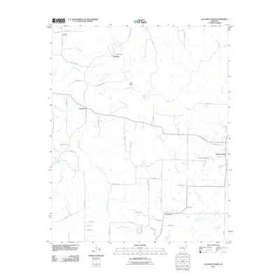
2011 Map of Pleasant Plains
USGS Topo · Published 2011About this map
Pleasant Plains serves as the primary hub for this rural stretch of Independence County, situated where modern local roads meet the undulating drainage basins of the Ozark foothills. The landscape is defined by a dense network of waterways including Salado Creek and Fourteenmile Creek, which have historically dictated the placement of settlements like Cedar Grove and Roosevelt. Notable for genealogists, the map preserves the locations of the Old Union Cemetery in the northwest and Pleasant Plains Cemetery to the east. The presence of Camp Tahkodah and Camp Crossed Arrows suggests a mid-century tradition of youth or recreational retreats centered around the riparian corridors of Wagon Wheel Creek and Bear Branch. This modern survey traces how earlier rural footprints have evolved into a grid of family-named lanes like Tom Conder Rd and Prince Reaper Rd.
Find a feature on this map
67 named features on this map. Tap any name to fly to it.
Don’t see what you’re looking for? This feature index may not catch every label — zoom into the map to look around manually.
Map Details
Editions of this 2011 Pleasant Plains Map
This is the sole edition of this map. No revisions or reprints were ever made.
Other maps of this area

1890 · Batesville
USGS Topo · 1:125,000

1891 · Batesville
USGS Topo · 1:125,000

1935 · Bald Knob
USGS Topo · 1:62,500

1942 · Jamestown
USGS Topo · 1:31,680

1942 · Almond
USGS Topo · 1:31,680

1942 · Salado
USGS Topo · 1:31,680

1953 · Memphis
USGS Topo · 1:250,000

1956 · Memphis
USGS Topo · 1:250,000

1962 · Pangburn
USGS Topo · 1:24,000
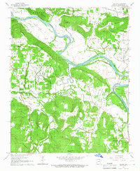
1965 · Salado
USGS Topo · 1:24,000