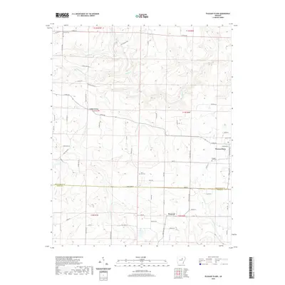
2020 Map of Pleasant Plains
USGS Topo · Published 2020About this map
Pleasant Plains and the smaller settlements of Cedar Grove and Roosevelt anchor this north-central Arkansas landscape near the border of Independence and White Counties. The area is defined by a dense network of watercourses, including the winding Salado Creek and various named tributaries like Wagon-Wheel Creek and Tenmile Creek. The road system reflects a mix of established regional routes such as Batesville Blvd and Floral Rd alongside numerous family-named lanes like Thompson Dr and Roberson Dr. Genealogy researchers will find significant value in the distribution of local burial sites, specifically Pleasant Plains Cemetery, Union Grove Cemetery, and Old Union Cemetery, which are spaced across the township and range divisions. The terrain shows a transition from the highlands down toward the creek beds, mapped with modern precision while preserving these long-standing community landmarks.
Find a feature on this map
75 named features on this map. Tap any name to fly to it.
Don’t see what you’re looking for? This feature index may not catch every label — zoom into the map to look around manually.
Map Details
Editions of this 2020 Pleasant Plains Map
This is the sole edition of this map. No revisions or reprints were ever made.
Other maps of this area

1890 · Batesville
USGS Topo · 1:125,000

1891 · Batesville
USGS Topo · 1:125,000

1935 · Bald Knob
USGS Topo · 1:62,500

1942 · Jamestown
USGS Topo · 1:31,680

1942 · Almond
USGS Topo · 1:31,680

1942 · Salado
USGS Topo · 1:31,680

1953 · Memphis
USGS Topo · 1:250,000

1956 · Memphis
USGS Topo · 1:250,000

1962 · Pangburn
USGS Topo · 1:24,000
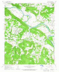
1965 · Salado
USGS Topo · 1:24,000