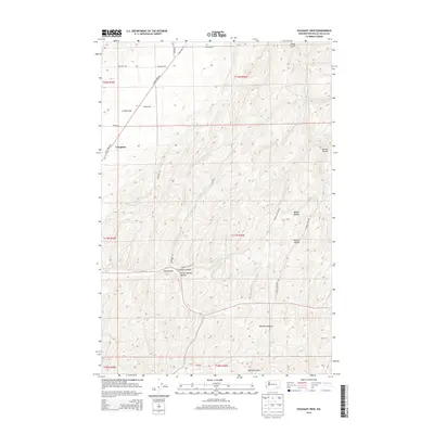
2014 Map of Pleasant View
USGS Topo · Published 2014About this map
Pleasant View and Tompkins sit within a landscape of deeply etched drainages and high plateaus in this 2014 survey of Walla Walla County. The terrain is defined by the contrast between the broad expanse of Eureka Flat in the northwest and the rising elevations of the Skyrocket Hills to the south. Significant erosional features like Manuel Hollow, Badger Hollow, and Winnett Canyon carve through the agricultural uplands, revealing the complex topography typical of the region. A network of rural roads, including Lyons Ferry Rd and Barstow Rd, connects these isolated settlements and follows the natural contours of the land. Water sources are sparse but notable, with Smith Springs and the associated Smith Springs Hollow marking important hydrologic points in an otherwise dry environment. The map provides a clear look at the township and range system, showing the boundaries of t11n r36e and surrounding sections as they intersect with the natural gulches and canyons.
Find a feature on this map
26 named features on this map. Tap any name to fly to it.
Don’t see what you’re looking for? This feature index may not catch every label — zoom into the map to look around manually.
Map Details
Editions of this 2014 Pleasant View Map
This is the sole edition of this map. No revisions or reprints were ever made.
Other maps of this area

1919 · Walla Walla
USGS Topo · 1:125,000

1921 · Walla Walla
USGS Topo · 1:125,000

1948 · Starbuck
USGS Topo · 1:62,500

1948 · Ayer
USGS Topo · 1:62,500

1950 · Starbuck
USGS Topo · 1:62,500

1950 · Haas
USGS Topo · 1:62,500

1953 · Walla Walla
USGS Topo · 1:250,000

1958 · Walla Walla
USGS Topo · 1:250,000
1967 · Prescott
USGS Topo · 1:24,000

1967 · Waitsburg NW
USGS Topo · 1:24,000