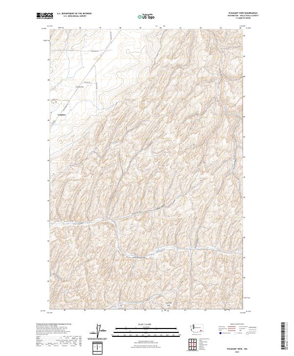
2023 Map of Pleasant View
USGS Topo · Published 2023About this map
Tompkins sits at the edge of the undulating grain fields and dry-land farming country typical of the Walla Walla region. The landscape is defined by its deep drainages and ridges, featuring prominent landforms such as Eureka Flat and the Skyrocket Hills. A network of winding roads, including Lyon's Ferry Rd and Barstow Rd, traces the contours of the terrain, connecting isolated homesteads and high-elevation agricultural plots. The map reveals the critical importance of water in this arid environment, evidenced by the named Smith Springs located within Smith Springs Hollow. Local geography is further characterized by numerous deep canyons and draws like Winnett Canyon and Badger Hollow, which shape the flow of the land and the placement of rural infrastructure.
Find a feature on this map
27 named features on this map. Tap any name to fly to it.
Don’t see what you’re looking for? This feature index may not catch every label — zoom into the map to look around manually.
Map Details
Editions of this 2023 Pleasant View Map
This is the sole edition of this map. No revisions or reprints were ever made.
Other maps of this area

1919 · Walla Walla
USGS Topo · 1:125,000

1921 · Walla Walla
USGS Topo · 1:125,000

1948 · Starbuck
USGS Topo · 1:62,500

1948 · Ayer
USGS Topo · 1:62,500

1950 · Starbuck
USGS Topo · 1:62,500

1950 · Haas
USGS Topo · 1:62,500

1953 · Walla Walla
USGS Topo · 1:250,000

1958 · Walla Walla
USGS Topo · 1:250,000
1967 · Prescott
USGS Topo · 1:24,000

1967 · Waitsburg NW
USGS Topo · 1:24,000