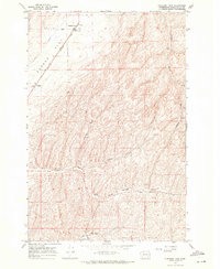
1967 Map of Pleasant View
USGS Topo · Published 1971About this map
Pleasant View and the surrounding agricultural landscapes of Walla Walla County define this topographic survey from the late 1960s. The northern reaches are dominated by the broad expanse of Eureka Flat, where the Burlington Northern railroad cuts a diagonal line across the terrain, serving several large Grain Elevators that anchor local industry. These elevators, alongside a Radio Facility and a Landing Strip, highlight the infrastructure necessary for large-scale farming in this part of Washington.
Find a feature on this map
28 named features on this map. Tap any name to fly to it.
Don’t see what you’re looking for? This feature index may not catch every label — zoom into the map to look around manually.
Map Details
Editions of this 1967 Pleasant View Map
This is the sole edition of this map. No revisions or reprints were ever made.
Other maps of this area

1919 · Walla Walla
USGS Topo · 1:125,000

1921 · Walla Walla
USGS Topo · 1:125,000

1948 · Starbuck
USGS Topo · 1:62,500

1948 · Ayer
USGS Topo · 1:62,500

1950 · Starbuck
USGS Topo · 1:62,500

1950 · Haas
USGS Topo · 1:62,500

1953 · Walla Walla
USGS Topo · 1:250,000

1958 · Walla Walla
USGS Topo · 1:250,000
1967 · Prescott
USGS Topo · 1:24,000

1967 · Waitsburg NW
USGS Topo · 1:24,000