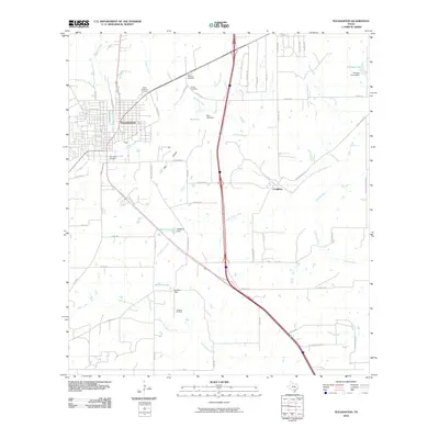
2010 Map of Pleasanton
USGS Topo · Published 2010About this map
The Atascosa River winds through the heart of this South Texas landscape, anchoring the city of Pleasanton and its surrounding rural corridors. In the early 21st century, the area shows a transition from structured town grids to an expansive network of ranch roads and water management features. Several significant local burial sites, including Saint Andrews Cemetery, Sotelo Cemetery, and San Ysidro Cemetery, provide valuable anchor points for genealogists and family historians.
Find a feature on this map
58 named features on this map. Tap any name to fly to it.
Don’t see what you’re looking for? This feature index may not catch every label — zoom into the map to look around manually.
Map Details
Editions of this 2010 Pleasanton Map
This is the sole edition of this map. No revisions or reprints were ever made.
Other maps of this area

1953 · Crystal City
USGS Topo · 1:250,000

1954 · San Antonio
USGS Topo · 1:250,000

1955 · Crystal City
USGS Topo · 1:250,000

1956 · Pleasanton
USGS Topo · 1:62,500

1956 · Jourdanton
USGS Topo · 1:62,500

1957 · San Antonio
USGS Topo · 1:250,000

1961 · Crystal City
USGS Topo · 1:250,000
1964 · Saspamco SE
USGS Topo · 1:24,000

1964 · Leming
USGS Topo · 1:24,000

1968 · Crystal City
USGS Topo · 1:250,000