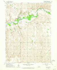
1962 Map of Pleasanton
USGS Topo · Published 1964About this map
Pleasanton serves as the central hub of this Nebraska landscape, situated along the northern banks of the South Loup River. The village shows its mid-century infrastructure clearly, including a prominent Water Tank and its proximity to the South Loup River Railroad Grade, which follows the river's winding course. The map captures the agricultural transition from the river valley to the upland prairies of Rusco and Cedar townships.
Find a feature on this map
14 named features on this map. Tap any name to fly to it.
Don’t see what you’re looking for? This feature index may not catch every label — zoom into the map to look around manually.
Map Details
Editions of this 1962 Pleasanton Map
This is the sole edition of this map. No revisions or reprints were ever made.
Other maps of this area

1896 · Kearney
USGS Topo · 1:125,000

1896 · Wood River
USGS Topo · 1:125,000

1899 · Loup
USGS Topo · 1:125,000

1951 · Litchfield SW
USGS Topo · 1:24,000

1951 · Hazard
USGS Topo · 1:24,000

1953 · Ravenna
USGS Topo · 1:24,000

1955 · Broken Bow
USGS Topo · 1:250,000

1955 · Grand Island
USGS Topo · 1:250,000

1956 · Broken Bow
USGS Topo · 1:250,000

1957 · Grand Island
USGS Topo · 1:250,000