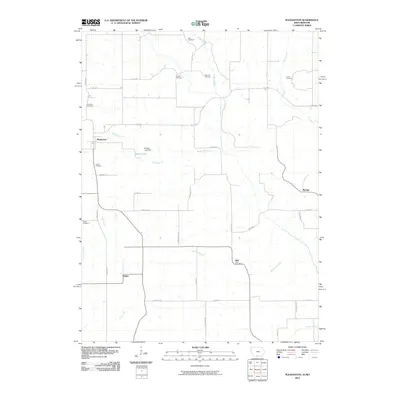
2010 Map of Pleasanton
USGS Topo · Published 2010About this map
Pleasanton anchors the western edge of this Iowa-Missouri border landscape, where the headwaters of numerous creeks begin their winding paths south. The terrain is marked by a high density of rural burial grounds, including Dale Cemetery, Cowles Cemetery, and Hamilton Cemetery, which suggest long-established family ties to the land. Settlement clusters around crossroad communities like Adel, home to the Adel Post Office, and Saline, positioned near the banks of Coal Creek. The central portion of the quadrangle features Shields Lake and the Shields Lake Dam, a notable artificial water body in a region otherwise defined by the dendritic drainage patterns of Kilgore Creek and Hickory Branch. The road network, composed of numerical and alphabetical routes like Co RD j66 and Basswood Ave, connects these small hubs across the undulating prairie topography.
Find a feature on this map
40 named features on this map. Tap any name to fly to it.
Don’t see what you’re looking for? This feature index may not catch every label — zoom into the map to look around manually.
Map Details
Editions of this 2010 Pleasanton Map
This is the sole edition of this map. No revisions or reprints were ever made.
Other maps of this area

1945 · Lamoni
USGS Topo · 1:62,500

1946 · Princeton
USGS Topo · 1:62,500

1947 · Lamoni
USGS Topo · 1:62,500

1947 · Blythedale
USGS Topo · 1:62,500

1948 · Princeton
USGS Topo · 1:62,500

1954 · Centerville
USGS Topo · 1:250,000

1957 · Centerville
USGS Topo · 1:250,000

1958 · Centerville
USGS Topo · 1:250,000

1964 · Woodland
USGS Topo · 1:24,000

1964 · Pleasanton
USGS Topo · 1:24,000