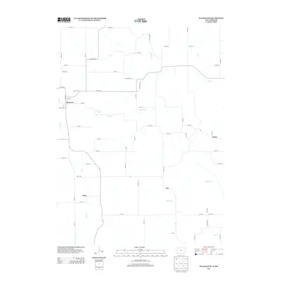
2013 Map of Pleasanton
USGS Topo · Published 2013About this map
Pleasanton sits directly on the border of Iowa and Missouri, anchoring a landscape where the grid-based road system of Decatur County meets the meandering drainage of the Thompson River watershed. This survey captures a rural territory defined by small, dispersed settlements like Adel and Saline, connected by a network of county highways and gravel roads such as Country Road 66. The hydrology of the region is prominent, with numerous named waterways including Marks Br and Kilgore Cr carving through the agricultural terrain. Shields Lake provides a localized water feature near the Iowa-Missouri line. In the eastern portion of the map, the community of Wataga serves as a local landmark amidst the rolling drainage basins of Lick Br and Hickory Br, illustrating the enduring spatial patterns of the Midwestern farm economy in the early 21st century.
Find a feature on this map
69 named features on this map. Tap any name to fly to it.
Don’t see what you’re looking for? This feature index may not catch every label — zoom into the map to look around manually.
Map Details
Editions of this 2013 Pleasanton Map
This is the sole edition of this map. No revisions or reprints were ever made.
Other maps of this area

1945 · Lamoni
USGS Topo · 1:62,500

1946 · Princeton
USGS Topo · 1:62,500

1947 · Lamoni
USGS Topo · 1:62,500

1947 · Blythedale
USGS Topo · 1:62,500

1948 · Princeton
USGS Topo · 1:62,500

1954 · Centerville
USGS Topo · 1:250,000

1957 · Centerville
USGS Topo · 1:250,000

1958 · Centerville
USGS Topo · 1:250,000

1964 · Woodland
USGS Topo · 1:24,000

1964 · Pleasanton
USGS Topo · 1:24,000