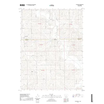
2018 Map of Pleasanton
USGS Topo · Published 2018About this map
Pleasanton sits at the northern edge of this landscape, where the border between Iowa and Missouri divides the terrain of Decatur County from Mercer County. The land is defined by a dense network of drainage, where small waterways like Kilgore Cr and Lick Br flow through the northern sections while Hickory Br and Brush Cr carve the southern reaches. This modern survey captures the rural character of the region, showing the community of Saline situated along State Hwy T. A high density of family and community burial grounds, including Dale Cem, Gammill Cem, and Hamilton Cem, are scattered across the township lines, providing valuable markers for local genealogists. The grid of country roads, such as Quarry Rd and Co Rd R46, connects these sites across the rolling hills and creek beds.
Find a feature on this map
60 named features on this map. Tap any name to fly to it.
Don’t see what you’re looking for? This feature index may not catch every label — zoom into the map to look around manually.
Map Details
Editions of this 2018 Pleasanton Map
This is the sole edition of this map. No revisions or reprints were ever made.
Other maps of this area

1945 · Lamoni
USGS Topo · 1:62,500

1946 · Princeton
USGS Topo · 1:62,500

1947 · Lamoni
USGS Topo · 1:62,500

1947 · Blythedale
USGS Topo · 1:62,500

1948 · Princeton
USGS Topo · 1:62,500

1954 · Centerville
USGS Topo · 1:250,000

1957 · Centerville
USGS Topo · 1:250,000

1958 · Centerville
USGS Topo · 1:250,000

1964 · Woodland
USGS Topo · 1:24,000

1964 · Pleasanton
USGS Topo · 1:24,000