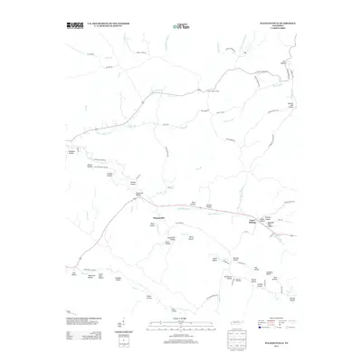
2013 Map of Pleasantville
USGS Topo · Published 2013About this map
Pleasantville serves as a focal point in this landscape of winding creeks and narrow hollows within Hickman County. The area is defined by its complex drainage systems, where Upper Sinking Cr and Cane Cr carve through the terrain, creating numerous named depressions such as Shelving Rock Hollow and Powder Mill Hollow. The settlement of Upper Sinking and the community at Farmers Exchange are connected by a network of local roads including McClearen Hollow Rd and Hell King Rd.
Find a feature on this map
83 named features on this map. Tap any name to fly to it.
Don’t see what you’re looking for? This feature index may not catch every label — zoom into the map to look around manually.
Map Details
Editions of this 2013 Pleasantville Map
This is the sole edition of this map. No revisions or reprints were ever made.
Other maps of this area

1936 · Graves Spring
USGS Topo · 1:24,000

1936 · Pleasantville
USGS Topo · 1:24,000

1936 · Coble
USGS Topo · 1:24,000

1936 · Beaverdam Springs
USGS Topo · 1:24,000

1936 · Whitfield
USGS Topo · 1:24,000

1936 · Linden
USGS Topo · 1:24,000

1936 · Chestnut Grove
USGS Topo · 1:24,000

1936 · Lobelville
USGS Topo · 1:24,000

1936 · Kimmins
USGS Topo · 1:24,000
1950 · Linden
USGS Topo · 1:24,000