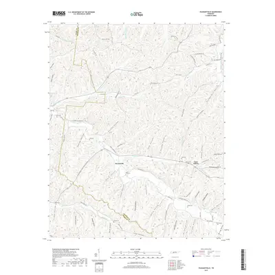
2019 Map of Pleasantville
USGS Topo · Published 2019About this map
The unincorporated community of Pleasantville serves as the central hub of this modern survey of Hickman and Perry Counties, where narrow valley floors and winding ridge roads define the settlement pattern. This landscape is marked by a high density of family cemeteries, such as Ayers Cem, Williams Cem, and Beech Grove Cem, which often occupy elevated ground overlooking the hollows. These features indicate long-standing family landholdings and small, dispersed kin-based communities common throughout the Tennessee hills.
Find a feature on this map
93 named features on this map. Tap any name to fly to it.
Don’t see what you’re looking for? This feature index may not catch every label — zoom into the map to look around manually.
Map Details
Editions of this 2019 Pleasantville Map
This is the sole edition of this map. No revisions or reprints were ever made.
Other maps of this area

1936 · Graves Spring
USGS Topo · 1:24,000

1936 · Pleasantville
USGS Topo · 1:24,000

1936 · Coble
USGS Topo · 1:24,000

1936 · Beaverdam Springs
USGS Topo · 1:24,000

1936 · Whitfield
USGS Topo · 1:24,000

1936 · Linden
USGS Topo · 1:24,000

1936 · Chestnut Grove
USGS Topo · 1:24,000

1936 · Lobelville
USGS Topo · 1:24,000

1936 · Kimmins
USGS Topo · 1:24,000
1950 · Linden
USGS Topo · 1:24,000