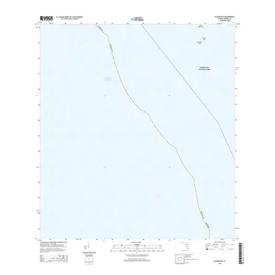
2015 Map of Plover Key
USGS Topo · Published 2015About this map
Everglades National Park covers the eastern reaches of this coastal quadrangle, preserving the fragile interface where the Florida mainland meets the open water. This maritime landscape is defined by small landforms such as Plover Key, North Plover Key, and Seminole Point, which serve as critical landmarks for navigating the shallow transition into the Gulf of Mexico. The boundary between the state and Monroe County underscores the jurisdictional layout of this coastal wilderness. The area remains dominated by natural features, with the map documenting the precise shoreline and island placements as they existed during this 2015 survey, providing a snapshot of the ever-shifting coastal geography in south Florida.
Find a feature on this map
7 named features on this map. Tap any name to fly to it.
Don’t see what you’re looking for? This feature index may not catch every label — zoom into the map to look around manually.
Map Details
Editions of this 2015 Plover Key Map
This is the sole edition of this map. No revisions or reprints were ever made.
Other maps of this area

1956 · Miami
USGS Topo · 1:250,000

1958 · Miami
USGS Topo · 1:250,000

1972 · Shark Point
USGS Topo · 1:24,000

1973 · Pavilion Key
USGS Topo · 1:24,000
1973 · Plover Key
USGS Topo · 1:24,000

1973 · Lostmans River Ranger Station
USGS Topo · 1:24,000

1973 · Alligator Bay
USGS Topo · 1:24,000

1981 · Cape Sable
USGS Topo · 1:100,000

1982 · Everglades City
USGS Topo · 1:100,000

1988 · Miami
USGS Topo · 1:250,000