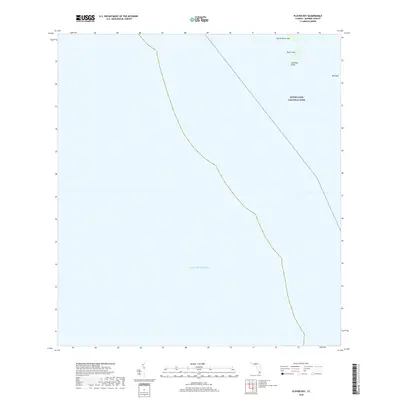
2018 Map of Plover Key
USGS Topo · Published 2018About this map
Everglades National Park covers the northeastern portion of this coastal chart, where the wilderness of the Florida coast meets the open waters of the Gulf of Mexico. The map documents a fragile coastal environment defined by small islands and points that serve as critical markers for navigation and local geography. These features, including North Plover Key, Plover Key, and Bird Key, represent the emergent landmasses at the edge of the mainland. The inclusion of Seminole Point highlights the subtle landforms that characterize this segment of Monroe County. This 2018 survey provides a precise modern baseline for the coastline, showing the spatial relationship between these named keys and the protected boundaries of the national park during a period of ongoing environmental monitoring.
Find a feature on this map
6 named features on this map. Tap any name to fly to it.
Don’t see what you’re looking for? This feature index may not catch every label — zoom into the map to look around manually.
Map Details
Editions of this 2018 Plover Key Map
This is the sole edition of this map. No revisions or reprints were ever made.
Other maps of this area

1956 · Miami
USGS Topo · 1:250,000

1958 · Miami
USGS Topo · 1:250,000

1972 · Shark Point
USGS Topo · 1:24,000

1973 · Pavilion Key
USGS Topo · 1:24,000
1973 · Plover Key
USGS Topo · 1:24,000

1973 · Lostmans River Ranger Station
USGS Topo · 1:24,000

1973 · Alligator Bay
USGS Topo · 1:24,000

1981 · Cape Sable
USGS Topo · 1:100,000

1982 · Everglades City
USGS Topo · 1:100,000

1988 · Miami
USGS Topo · 1:250,000