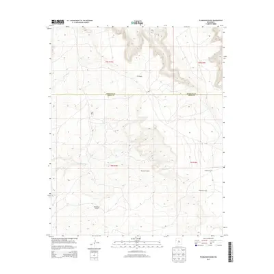
2013 Map of Plumasano Basin
USGS Topo · Published 2013About this map
Plumasano Basin dominates this landscape in western New Mexico, where the high-desert terrain is carved by seasonal drainages and punctuated by massive mesas. The boundary between McKinley and Cibola counties runs through the northern half of the sheet, dividing a region defined by its significant geological features rather than human settlements. To the north, the plateau of Pie Mesa rises sharply above the surrounding flats, while Red Mesa stands as a prominent landmark further west.
Find a feature on this map
15 named features on this map. Tap any name to fly to it.
Don’t see what you’re looking for? This feature index may not catch every label — zoom into the map to look around manually.
Map Details
Editions of this 2013 Plumasano Basin Map
This is the sole edition of this map. No revisions or reprints were ever made.
Other maps of this area

1886 · Wingate
USGS Topo · 1:250,000

1892 · Wingate
USGS Topo · 1:250,000

1954 · Saint Johns
USGS Topo · 1:250,000

1954 · Gallup
USGS Topo · 1:250,000

1957 · Saint Johns
USGS Topo · 1:250,000

1958 · Gallup
USGS Topo · 1:250,000

1958 · Saint Johns
USGS Topo · 1:250,000

1959 · Gallup
USGS Topo · 1:250,000

1962 · Gallup
USGS Topo · 1:250,000

1962 · Saint Johns
USGS Topo · 1:250,000