
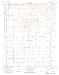
1960 Map of Plymell
USGS Topo · Published 1961About this map
Plymell serves as the primary settlement hub in this southwestern Kansas landscape, appearing as it did during the 1960 field check. The terrain is defined by a dense grid of extraction infrastructure, with dozens of individual Gas Well sites scattered across the townships of Garden City, Ivanhoe, and Pierceville. These labels indicate a mid-century energy boom that transformed the prairie surface. Beyond the energy sector, the map documents early telecommunications infrastructure, such as the Tower (KGLD-TV), providing a specific point of reference for local historians. This survey also records a network of fine red dashed lines that represent fence and field lines visible from 1958 aerial photography, offering a precise look at historical land division and agricultural boundaries in Finney County before modern consolidation.
Find a feature on this map
9 named features on this map. Tap any name to fly to it.
Don’t see what you’re looking for? This feature index may not catch every label — zoom into the map to look around manually.
Map Details
Editions of this 1960 Plymell Map
2 editions found
Other maps of this area

1896 · Garden
USGS Topo · 1:125,000

1955 · Dodge City
USGS Topo · 1:250,000

1958 · Dodge City
USGS Topo · 1:250,000

1959 · Dodge City
USGS Topo · 1:250,000

1959 · Garden City 3 NW
USGS Topo · 1:24,000

1959 · Garden City 3 NE
USGS Topo · 1:24,000

1960 · Garden City East
USGS Topo · 1:24,000

1960 · Garden City SW
USGS Topo · 1:24,000
1960 · Garden City West
USGS Topo · 1:24,000

1967 · Pierceville SW
USGS Topo · 1:24,000