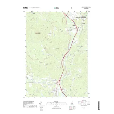
2021 Map of Plymouth
USGS Topo · Published 2021About this map
The Pemigewasset River flows through the heart of this region, shaping the development of the valley and its many distinct villages. In the north, several settlements including Campton Station, Campton Upper Village, and West Campton cluster near the river, while the historic Blair Bridge and Turkey Jims Bridge provide essential crossings. This 2021 record shows the enduring footprint of education at Plymouth State University and the regional infrastructure of the Plymouth Municipal Airport. The landscape is a mix of settled valley plains and protected highlands within the White Mountain National Forest. Genealogists will find numerous family-centric sites, such as the Trinity Church Yard Cem and Campton Hollow Cem, alongside prominent natural features like Bald Mtn and Livermore Falls.
Find a feature on this map
111 named features on this map. Tap any name to fly to it.
Don’t see what you’re looking for? This feature index may not catch every label — zoom into the map to look around manually.
Map Details
Editions of this 2021 Plymouth Map
This is the sole edition of this map. No revisions or reprints were ever made.
Other maps of this area

1925 · Holderness
USGS Topo · 1:62,500

1927 · Holderness
USGS Topo · 1:62,500

1927 · Cardigan
USGS Topo · 1:62,500

1928 · Plymouth
USGS Topo · 1:62,500

1928 · Rumney
USGS Topo · 1:62,500

1930 · Cardigan
USGS Topo · 1:62,500

1931 · Plymouth
USGS Topo · 1:62,500

1932 · Rumney
USGS Topo · 1:62,500

1949 · Portland
USGS Topo · 1:250,000

1956 · Cardigan
USGS Topo · 1:62,500