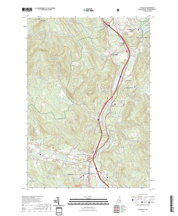
2024 Map of Plymouth
USGS Topo · Published 2024About this map
Plymouth serves as the primary hub of activity on this modern survey, defined by its position at the confluence of the Baker River and the Pemigewasset River. The campus of Plymouth State University dominates the town center, while transportation infrastructure like the Plymouth Municipal Airport and Interstate 93 shape the local corridor. To the north, the landscape transitions into the heavily forested reaches of the White Mountain National Forest, where high points such as Bald Mtn and Mt Pero overlook the river valleys.
Find a feature on this map
113 named features on this map. Tap any name to fly to it.
Don’t see what you’re looking for? This feature index may not catch every label — zoom into the map to look around manually.
Map Details
Editions of this 2024 Plymouth Map
This is the sole edition of this map. No revisions or reprints were ever made.
Other maps of this area

1925 · Holderness
USGS Topo · 1:62,500

1927 · Holderness
USGS Topo · 1:62,500

1927 · Cardigan
USGS Topo · 1:62,500

1928 · Plymouth
USGS Topo · 1:62,500

1928 · Rumney
USGS Topo · 1:62,500

1930 · Cardigan
USGS Topo · 1:62,500

1931 · Plymouth
USGS Topo · 1:62,500

1932 · Rumney
USGS Topo · 1:62,500

1949 · Portland
USGS Topo · 1:250,000

1956 · Cardigan
USGS Topo · 1:62,500