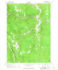
1966 Map of Plymouth
USGS Topo · Published 1968About this map
Calvin Coolidge State Forest dominates this Windsor County landscape, framing a region deeply connected to presidential history and rural Vermont industry in the mid-1960s. The village of Plymouth serves as a focal point, noted specifically for the Calvin Coolidge Birthplace and the nearby Plymouth Notch Cem. The terrain is defined by steep ridges and narrow valleys, where the Ottauquechee River and Black River gather their headwaters.
Find a feature on this map
59 named features on this map. Tap any name to fly to it.
Don’t see what you’re looking for? This feature index may not catch every label — zoom into the map to look around manually.
Map Details
Editions of this 1966 Plymouth Map
2 editions found
Other maps of this area

1891 · Rutland
USGS Topo · 1:62,500

1893 · Wallingford
USGS Topo · 1:62,500

1893 · Rutland
USGS Topo · 1:62,500

1911 · Woodstock
USGS Topo · 1:62,500

1913 · Woodstock
USGS Topo · 1:62,500

1928 · Ludlow
USGS Topo · 1:48,000

1929 · Ludlow
USGS Topo · 1:62,500

1932 · Ludlow
USGS Topo · 1:62,500

1943 · Woodstock
USGS Topo · 1:62,500

1950 · Glens Falls
USGS Topo · 1:250,000