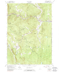
1966 Map of Plymouth
USGS Topo · Published 1989About this map
Calvin Coolidge Birthplace sits at the heart of this mid-1960s Vermont landscape, marking the historic center of Plymouth. The map captures the tight relationship between the region's steep topography and its settlement patterns, where small hamlets like Plymouth Union and Bridgewater Corners cluster along the narrow valleys of the Ottauquechee River and the Black River. The presence of the Round Top Mtn Ski Area reflects the mid-century evolution of these Green Mountain slopes from agricultural and timber use toward recreation and tourism.
Find a feature on this map
63 named features on this map. Tap any name to fly to it.
Don’t see what you’re looking for? This feature index may not catch every label — zoom into the map to look around manually.
Map Details
Editions of this 1966 Plymouth Map
2 editions found
Other maps of this area

1891 · Rutland
USGS Topo · 1:62,500

1893 · Wallingford
USGS Topo · 1:62,500

1893 · Rutland
USGS Topo · 1:62,500

1911 · Woodstock
USGS Topo · 1:62,500

1913 · Woodstock
USGS Topo · 1:62,500

1928 · Ludlow
USGS Topo · 1:48,000

1929 · Ludlow
USGS Topo · 1:62,500

1932 · Ludlow
USGS Topo · 1:62,500

1943 · Woodstock
USGS Topo · 1:62,500

1950 · Glens Falls
USGS Topo · 1:250,000