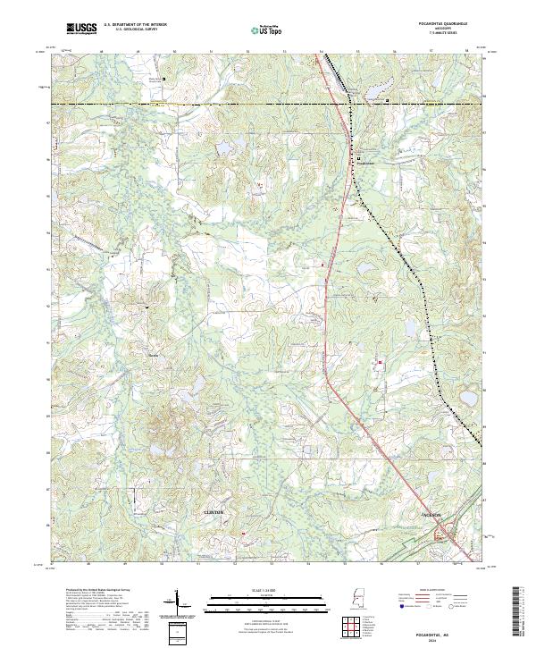
2024 Map of Pocahontas
USGS Topo · Published 2024About this map
Bogue Chitto Creek and its many tributaries, including Linekiln Creek and Straight Fence Creek, define the rolling landscape of northern Hinds and Madison counties. This modern topographic view documents the interface between the growing northern reaches of Jackson and Clinton and the established communities of Pocahontas and Tinnin. Significant local landmarks include the Slobovia Outernational Airport and the historic Natchez Trace Parkway which cuts through the southeastern corner of the quadrangle. Several small burial grounds and places of worship, such as Shady Grove Church and Pocahontas Cem, remain central to the region's geography. The map also traces modern infrastructure like Medgar Evers Blvd, which follows a primary transit corridor through the heart of the settlement area.
Find a feature on this map
88 named features on this map. Tap any name to fly to it.
Don’t see what you’re looking for? This feature index may not catch every label — zoom into the map to look around manually.
Map Details
Editions of this 2024 Pocahontas Map
This is the sole edition of this map. No revisions or reprints were ever made.
Other maps of this area

1903 · Jackson
USGS Topo · 1:125,000

1905 · Jackson
USGS Topo · 1:48,000

1908 · Jackson
USGS Topo · 1:62,500

1934 · Raymond
USGS Topo · 1:48,000

1937 · Raymond
USGS Topo · 1:62,500

1942 · Raymond
USGS Topo · 1:62,500

1955 · Jackson
USGS Topo · 1:250,000

1961 · Jackson
USGS Topo · 1:250,000

1961 · Canton
USGS Topo · 1:62,500

1962 · Jackson
USGS Topo · 1:250,000