
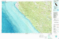
1981 Map of Point Arena
USGS Topo · Published 1981About this map
The San Andreas Rift Zone dictates the dramatic geography of this coastline, running parallel to the shore from Arena Cove south past the Gualala River. In the early 1980s, the landscape is defined by the proximity of the Pacific Ocean to the high ridges of the Coast Range, including Signal Ridge and Buck Ridge. The map documents a significant engineering change in the interior with the presence of the Warm Springs Dam and the resulting Lake Sonoma, altering the local hydrology near the Russian River basin.
Find a feature on this map
67 named features on this map. Tap any name to fly to it.
Don’t see what you’re looking for? This feature index may not catch every label — zoom into the map to look around manually.
Map Details
Editions of this 1981 Point Arena Map
2 editions found
Other maps of this area

1920 · Healdsburg
USGS Topo · 1:62,500

1920 · Ukiah
USGS Topo · 1:62,500

1921 · Skaggs
USGS Topo · 1:62,500

1921 · Kelseyville
USGS Topo · 1:62,500

1921 · Plantation
USGS Topo · 1:62,500

1933 · Healdsburg
USGS Topo · 1:48,000

1935 · Sebastopol
USGS Topo · 1:48,000

1938 · Lakeport
USGS Topo · 1:62,500

1938 · Hopland
USGS Topo · 1:62,500

1940 · Healdsburg
USGS Topo · 1:62,500