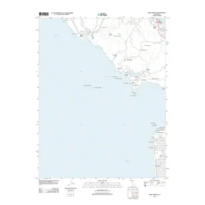
2012 Map of Point Bonita
USGS Topo · Published 2012About this map
Point Bonita Lighthouse stands at the treacherous entrance to the San Francisco Bay, anchoring a landscape where military history and coastal preservation meet. The Marin Headlands are defined by coastal defense sites such as Battery Mendell and Battery Alexander Campground, alongside protected spaces like the Golden Gate Recreation Area. This coastal survey highlights the transition from the developed edges of Marin City and Waldo to the open terrain of Gerbode Valley and Frank Valley. To the south, across the water, the map traces the urban shoreline of San Francisco at Ocean Beach and Lands End. Notable recreation and agriculture are represented by Golden Gate Park Golf Course and Green Gulch Farm, while the notorious offshore hazard of Potatopatch Shoal marks the northern approach to the Golden Gate.
Find a feature on this map
85 named features on this map. Tap any name to fly to it.
Don’t see what you’re looking for? This feature index may not catch every label — zoom into the map to look around manually.
Map Details
Editions of this 2012 Point Bonita Map
This is the sole edition of this map. No revisions or reprints were ever made.
Other maps of this area

1892 · San Mateo
USGS Topo · 1:62,500

1895 · San Francisco
USGS Topo · 1:62,500

1896 · San Mateo
USGS Topo · 1:62,500

1897 · Tamalpais
USGS Topo · 1:62,500

1899 · San Francisco
USGS Topo · 1:62,500

1899 · San Mateo
USGS Topo · 1:62,500

1915 · San Mateo
USGS Topo · 1:62,500

1915 · San Francisco
USGS Topo · 1:62,500

1939 · San Mateo
USGS Topo · 1:62,500

1941 · Tamalpais
USGS Topo · 1:62,500