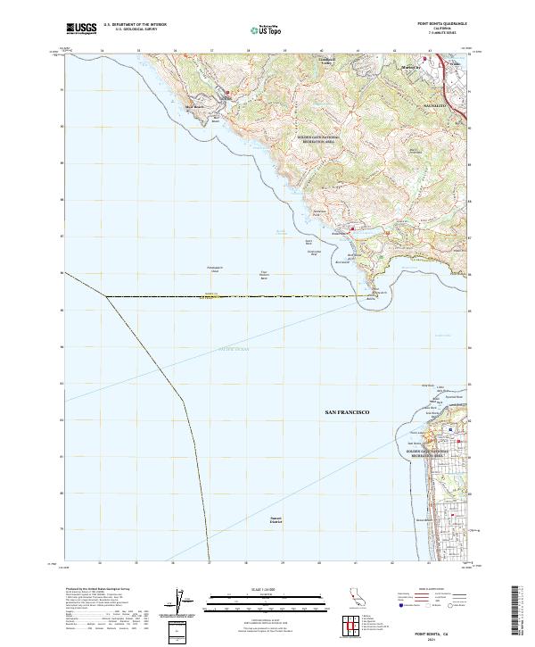
2021 Map of Point Bonita
USGS Topo · Published 2021About this map
Sausalito and the surrounding headlands of the Golden Gate National Recreation Area are documented in this contemporary survey, showing the complex interface between urban San Francisco and the protected coastal ridges. The map traces a dense network of hiking and fire trails, including the Miwok Trl, Coastal Trl, and Old Springs Trl, which navigate the steep elevations of Coyote Ridge and Wolf Ridge. To the south, across the Golden Gate, the survey details the northern edge of the Sunset District and the prominent headland of Point Lobos. Insights into the region’s natural and military history are visible through features like Rodeo Lagoon, the steep coastal cliffs at Lands End, and named coastal landmarks such as Point Bonita and Point Diablo. The geography reveals a landscape preserved for recreation, where developed areas like Marin City and Waldo give way to the expansive open spaces of Frank Valley and Gerbode Valley.
Find a feature on this map
111 named features on this map. Tap any name to fly to it.
Don’t see what you’re looking for? This feature index may not catch every label — zoom into the map to look around manually.
Map Details
Editions of this 2021 Point Bonita Map
This is the sole edition of this map. No revisions or reprints were ever made.
Other maps of this area

1892 · San Mateo
USGS Topo · 1:62,500

1895 · San Francisco
USGS Topo · 1:62,500

1896 · San Mateo
USGS Topo · 1:62,500

1897 · Tamalpais
USGS Topo · 1:62,500

1899 · San Francisco
USGS Topo · 1:62,500

1899 · San Mateo
USGS Topo · 1:62,500

1915 · San Mateo
USGS Topo · 1:62,500

1915 · San Francisco
USGS Topo · 1:62,500

1939 · San Mateo
USGS Topo · 1:62,500

1941 · Tamalpais
USGS Topo · 1:62,500