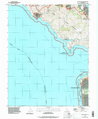
1993 Map of Point Bonita
USGS Topo · Published 1997About this map
Muir Beach and the coastal edges of the Golden Gate National Recreation Area dominate this coastal survey. The geography transition from the residential hills of Sausalito and Marin City in the north to the urban grid of San Francisco in the south is broken only by the steep cliffs and open water of the Golden Gate. Coastal navigation is defined by landmarks like the Beacon at Point Bonita and the cluster of rocks near Point Lobos, including Seal Rocks and Mile Rock.
Find a feature on this map
57 named features on this map. Tap any name to fly to it.
Don’t see what you’re looking for? This feature index may not catch every label — zoom into the map to look around manually.
Map Details
Editions of this 1993 Point Bonita Map
This is the sole edition of this map. No revisions or reprints were ever made.
Other maps of this area

1892 · San Mateo
USGS Topo · 1:62,500

1895 · San Francisco
USGS Topo · 1:62,500

1896 · San Mateo
USGS Topo · 1:62,500

1897 · Tamalpais
USGS Topo · 1:62,500

1899 · San Francisco
USGS Topo · 1:62,500

1899 · San Mateo
USGS Topo · 1:62,500

1915 · San Mateo
USGS Topo · 1:62,500

1915 · San Francisco
USGS Topo · 1:62,500

1939 · San Mateo
USGS Topo · 1:62,500

1941 · Tamalpais
USGS Topo · 1:62,500