
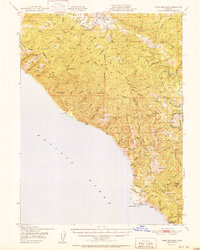
1951 Map of Point Delgada
USGS Topo · Published 1951About this map
Point Delgada and the southern reaches of the King Range define this mid-century survey of the Humboldt County coastline. The landscape is characterized by steep ridges and dramatic vertical drops, such as Kaluna Cliff, where the mountains meet the Pacific. The Mattole River snakes through the northern interior, serving as a primary drainage for the surrounding heights of Moody Ridge and Wilder Ridge. At the time of this 1949 field check, human presence was concentrated around the coastal outpost of Shelter Cove and the inland settlement of Honeydew.
Find a feature on this map
64 named features on this map. Tap any name to fly to it.
Don’t see what you’re looking for? This feature index may not catch every label — zoom into the map to look around manually.
Map Details
Editions of this 1951 Point Delgada Map
2 editions found
Other maps of this area

1919 · Glynn
USGS Topo · 1:62,500

1920 · Pt. Delagda
USGS Topo · 1:62,500

1921 · Dyerville
USGS Topo · 1:62,500

1921 · Briceland
USGS Topo · 1:62,500

1921 · Cape Mendocino
USGS Topo · 1:62,500

1926 · Gorda
USGS Topo · 1:62,500

1949 · Eureka
USGS Topo · 1:250,000

1949 · Point Delgada
USGS Topo · 1:62,500

1949 · Garberville
USGS Topo · 1:62,500

1949 · Weott
USGS Topo · 1:62,500