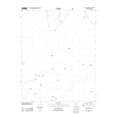
2012 Map of Point Imperial
USGS Topo · Published 2012About this map
Point Imperial dominates the western elevation of this high-country landscape, providing a critical vantage point overlooking the complex drainage systems that feed into the Colorado River to the east. The terrain is defined by a series of prominent landforms and named overlooks, including Seiber Point, Marion Point, and Bourke Point, which separate the various branches of Nankoweap Cr and Little Nankoweap Cr. This 2012 survey illustrates the remote network of Forest Service roads, such as FS RD 8910 and Cape Royal Rd, which provide the only vehicle access to these isolated points. Cultural and geological landmarks like Kolb Arch and Mount Hayden are precisely located among the named buttes, such as Woolsey Butte, Hancock Butte, and Novinger Butte, highlighting the intricate vertical geography and the specific nomenclature used by the U.S. Geological Survey to identify features within this section of Coconino County.
Find a feature on this map
26 named features on this map. Tap any name to fly to it.
Don’t see what you’re looking for? This feature index may not catch every label — zoom into the map to look around manually.
Map Details
Editions of this 2012 Point Imperial Map
This is the sole edition of this map. No revisions or reprints were ever made.
Other maps of this area

1886 · Echo Cliffs
USGS Topo · 1:250,000

1886 · Kaibab
USGS Topo · 1:250,000

1891 · Echo Cliffs
USGS Topo · 1:250,000

1903 · Bright Angel
USGS Topo · 1:48,000

1906 · Bright Angel
USGS Topo · 1:48,000

1907 · Vishnu
USGS Topo · 1:48,000

1953 · Grand Canyon
USGS Topo · 1:250,000

1954 · Nankoweap
USGS Topo · 1:62,500

1956 · Marble Canyon
USGS Topo · 1:250,000

1957 · Grand Canyon
USGS Topo · 1:250,000