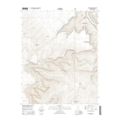
2014 Map of Point Imperial
USGS Topo · Published 2014About this map
The Colorado River carves through the northeast corner of this terrain in Coconino County, marking a dramatic boundary between the high plateaus and the deep gorge. This 2014 survey captures a landscape defined by extreme verticality and the isolation of the Arizona strip. While the river remains the primary geographic anchor, inland water sources like the Saddle Canyon Tank indicate the vital, scarce resources required for land management in this arid environment. The map details the intricate topography of the canyon walls and the transition between protected federal lands, illustrating the complex management of one of the world's most recognizable natural landmarks.
Find a feature on this map
2 named features on this map. Tap any name to fly to it.
Don’t see what you’re looking for? This feature index may not catch every label — zoom into the map to look around manually.
Map Details
Editions of this 2014 Point Imperial Map
This is the sole edition of this map. No revisions or reprints were ever made.
Other maps of this area

1886 · Echo Cliffs
USGS Topo · 1:250,000

1886 · Kaibab
USGS Topo · 1:250,000

1891 · Echo Cliffs
USGS Topo · 1:250,000

1903 · Bright Angel
USGS Topo · 1:48,000

1906 · Bright Angel
USGS Topo · 1:48,000

1907 · Vishnu
USGS Topo · 1:48,000

1953 · Grand Canyon
USGS Topo · 1:250,000

1954 · Nankoweap
USGS Topo · 1:62,500

1956 · Marble Canyon
USGS Topo · 1:250,000

1957 · Grand Canyon
USGS Topo · 1:250,000