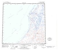
1951 Map of Point Lay
USGS Topo · Published 1956About this map
The remote shoreline of the Chukchi Sea and Arctic Ocean defines this northern landscape, where the settlement of Point Lay sits along the protected Kasegaluk Lagoon. Mapped from photography taken between 1943 and 1947, the region shows a sparse human footprint centered on seasonal movement and coastal access, notably marked by a Winter Trail cutting across the tundra toward Cape Beaufort.
Find a feature on this map
16 named features on this map. Tap any name to fly to it.
Don’t see what you’re looking for? This feature index may not catch every label — zoom into the map to look around manually.
Map Details
Editions of this 1951 Point Lay Map
2 editions found
Other maps of this area

1951 · De Long Mountains
USGS Topo · 1:250,000

1951 · Utukok River
USGS Topo · 1:250,000

1951 · Wainwright
USGS Topo · 1:250,000

1951 · Point Lay
USGS Topo · 1:250,000

1951 · Misheguk Mountain
USGS Topo · 1:250,000

1952 · Point Hope
USGS Topo · 1:250,000

1952 · Point Hope D-1
USGS Topo · 1:63,360

1955 · Wainwright
USGS Topo · 1:250,000

1955 · De Long Mountains
USGS Topo · 1:250,000

1955 · Point Lay
USGS Topo · 1:250,000