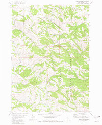
1981 Map of Point Lookout
USGS Topo · Published 1981About this map
Caribou National Forest dominates this landscape of eastern Idaho, as recorded in a 1981 edition that highlights the complex drainage systems of the region. The terrain is defined by high points like Point Lookout and Mt Baldy, with numerous named waterways such as Deep Creek, Tex Creek, and Sawmill Creek carving through the valleys. The map illustrates a network of unimproved roads and trails that traverse the forest, providing access to landmarks like Ballys Hole and Bates Canyon. A solitary Radio Facility stands out as a modern installation amidst the natural features. This survey provides a clear view of the area's geography before significant modern development, showing the transition between the high ridges and the deep drainages like Dry Hollow and Indian Creek, making it a valuable resource for understanding the land use and topography of this part of Bonneville County.
Find a feature on this map
24 named features on this map. Tap any name to fly to it.
Don’t see what you’re looking for? This feature index may not catch every label — zoom into the map to look around manually.
Map Details
Editions of this 1981 Point Lookout Map
This is the sole edition of this map. No revisions or reprints were ever made.
Other maps of this area

1924 · Hell Creek
USGS Topo · 1:62,500

1926 · Hell Creek
USGS Topo · 1:62,500

1932 · Irwin
USGS Topo · 1:96,000

1935 · Irwin
USGS Topo · 1:125,000

1943 · Garns Mtn
USGS Topo · 1:62,500

1946 · Garns Mtn
USGS Topo · 1:62,500

1951 · Poplar
USGS Topo · 1:24,000

1951 · Heise SE
USGS Topo · 1:24,000

1955 · Driggs
USGS Topo · 1:250,000

1958 · Driggs
USGS Topo · 1:250,000